Above:
The Point Campground is available only by a 3 mile boat
trip.
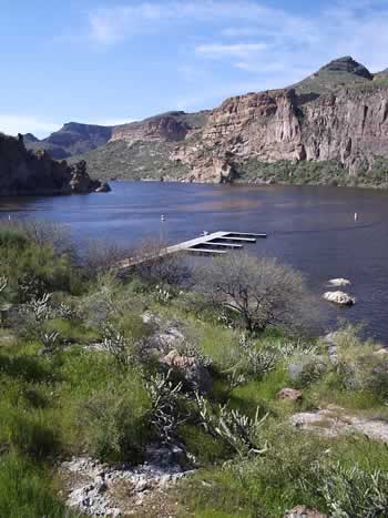
The
Point Campground is accessible only by a three
mile boat trip on Canyon Lake. Although there is no fee
for using the campsite, there is a small fee of $2 per watercraft
and $4 per vehicle per day at Canyon Lake. The Point has
the only restroom facility on upper Canyon Lake. Canyon
Lake has a full-service marina with boat rental, bait &
tackle, emergency (911) phone, excursion boat, restaurant,
snack bar, picnic supplies, ice, beach and lakeside picnicking.
Glass containers are not allowed at Canyon Lake. Also, there
is no trash service available, PACK IT IN, PACK
IT OUT! Be careful with both boat fuel and any
soap for cleaning dishes etc. soap is not allowed in the
water! There is a boat sewage dump available at the marina.
Directions
This
site is 17 miles northeast of Apache Junction on Arizona
State Hwy. 88, (historic “Apache Trail”). From
Mesa, take US 60 to the Idaho Road exit go north on Idaho
Road to State Hwy. 88 and turn right. After crossing the
first bridge at the lake, watch for Palo Verde Recreation
Site sign and turn left into that site. The entire route
to the lake is paved with narrow, sharp curves, traffic
is heavy. The last 3 miles are by boat.