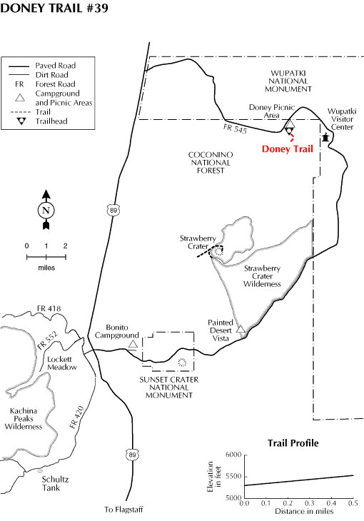
If you're interested in a short scenic walk in desert volcano country, with a great view of the painted desert and the San Francisco Peaks at trail's end, you'll want to check out the Doney Trail. This half mile hike begins at the Doney Picnic Area and climbs gradually up the side of a volcanic cinder cone to a panoramic overlook. Interpretive signs posted along the way tell you about the unique ecology of this rugged area and about the adventures of Ben Doney who prospected these hills for gold. You'll even see one of Doney's old digs along the way. Also along the trail you'll see two prehistoric ruins with signs interpreting their role in the local community and how they related to prehistoric farming practices
If you don't have lunch at the picnic area,you might want to pack it along. There's a bench at the top of the climb where you can savor your snack while you enjoy the scenery. An interpretive sign there gives you the contemporary as well as the Hopi names of all the landmarks in the view. It provides interesting mealtime reading. (Don't forget to pack out everything you brought in. You wouldn't want to spoil the dining room for the next person.)
General Information
Directions:
Location: 32 miles (45 minutes) northeast of Flagstaff in volcano andIndian ruin country.
Access: From Flagstaff, drive 22 miles on AZ 89 to the north end of the Wupatki Loop Road and turn east 9.5 miles to the Doney Picnic Area and the trailhead. All roads are paved.
USGS Maps: Wupatki SW
General Notes:
Rating: Easy
Notes: No motor vehicles
Usage: Medium
Longitude: 35.531736
Latitude: -111.404498
Nearest Town: Flagstaff
Operated By: Flagstaff Ranger District - 928-526-0866