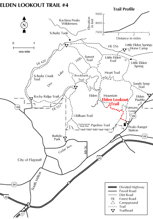
From its base, the southeastern slope of Mount Elden looks like corduroy cast in stone. This trail leads you up that staircase of petrified lava to the mountain's summit 2,300 feet above Flagstaff. The route starts as a gradual climb along the shorter and less steep Fatman's Loop but increases in gradient as the Lookout Trail strikes out on its own ascent to the mountain top. Along the way, you'll want to stop and catch your breath while you enjoy breathtaking views of the city and surrounding area as well as intimate views of the mountain's very visible geology.
The lower reaches of the trail pass through a mixed pinyon-juniper woodland and ponderosa pine forest changing to mixed conifers as you climb. You may be surprised to encounter a couple of different kinds of cactus in this high, cold environment where they seem to do very well.
Near the top of the climb you'll walk through an area devastated by a huge wildfire in 1977. Here, you'll see how much destruction can result when a simple campfire gets out of control. At the same time, you'll get a first hand look at how nature recovers from such a catastrophic event. Groves of aspen trees are springing up where pines once stood. They are the first step in a chain of events that will eventually result in the growth of another pine forest here. Before that happens, Flagstaff and its visitors will get to enjoy many years of fall colors visible from most of town.
The Elden Lookout Trail connects to the Oldham Trail at the top of the mountain making an extended hike possible if you park a car at Buffalo Park or arrange a pickup there. The photo above is a view of the towers at the top of the mountain.
General Information
General Notes:
Rating: Strenuous
Hiking time: 2.5 hours
Notes: No motorized vehicles, no horses because of the trail's extreme steep grade.
Directions:
USGS Map: Flagstaff East
Location: Near the Flagstaff Mall on Highway 89 in east Flagstaff.
GPS: N35° 13' 48.7554", W-111° 34' 45.3"
Access: Follow Highway 89 past the entrance to the Flagstaff Mall and the Flagstaff Ranger District Office to a trailhead parking lot just off the north side of the street.
Usage: Medium
Area/Length
Best Season: April Through November
Closest Town: Flagstaff
Operated By: Flagstaff Ranger District - 928-526-0866