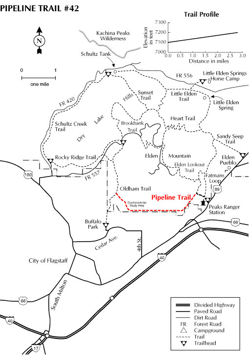
Pipeline Trail begins just north of Buffalo Park, Flagstaff's urban forest preserve, and follows a gas pipeline right-of-way along the base of Mt. Elden. This broad, open trail offers an easy hike across fairly open terrain with opportunities to get a close look at the lower limits of some of the old Mt. Elden lava flows. It also offers easy access to some of the many small rocky canyons that carve Mt. Elden's lower slopes. Ponderosa pines are the predominant vegetation along the trail, mixed with Gambel oaks that color the slopes a burnt gold in the fall and cliffrose that contribute a pleasant fragrance in the spring.
Much of the Pipeline Trail passes through the Mt. Elden Environmental Study Area (ESA). This is an area set aside by the Forest Service in the mid-nineteen seventies as an outdoor study resource for schools and environmental groups. Gray foxes and coyotes can be seen along the trail as well as an occasional raccoon. Common birds encountered here are Steller's jays, juncos and a variety of hawks that hunt the rocky slopes. Open areas annually tinted bright yellow with a midsummer wash of sunflowers serve as a colorful stage for that countryside Caruso, the Meadow lark.
Pipeline Trail provides a connecting route between the Oldham and Mt. Elden/Fatman's Loop trails. It also serves as a cross-country mountain biking route between east and west Flagstaff.
At a Glance
Usage:
Medium-Heavy
Best Season:
April thru November
Closest Towns:
Flagstaff, AZ
Operated By:
Flagstaff Ranger District - 928-526-0866
General Information
Directions:
USGS Map: Flagstaff East
Location: Along the northern edge of the city of Flagstaff.
Access: Pipeline Trail is accessible via the Oldham Trail out of Buffalo Park and the Elden Lookout Trail located in East Flagstaff off US Highway 89.