Devil's Bridge is the largest natural sandstone arch in the Sedona area; don't let its name fool you: It's one of the most heavenly sights in an area famous for them.
From a trailhead elevation of 4,600 feet, there's a mere 400 foot climb in altitude during this moderately difficult, 1.8-mile roundtrip trek; the journey to reach the top won't leave you breathless -- but we would never say the same about the views you'll witness when you finally get there.
This popular hike has attractions for both casual hikers who lack the desire or the stamina to stray too far from civilization, and the more adventurous outdoors enthusiasts. Starting at the parking area, follow the trailmarker that points the way to Devil's Bridge Trail. You'll find the early going effortless; the trail, originally built for jeep travel, is smooth and clear and leads you through washes filled with juniper and prickly pear cactus.
The path slowly inclines uphill, gently growing more steep as you progress. There's some beautiful scenery to absorb as you proceed upward, but you've still got a ways to go before you get to see Devil's Bridge itself.
After you've walked about three-quarters of a mile from the parking area, the trail will divide. Head down the path to the left and you'll end up at the base of the bridge. For a cool view, stand directly under the 50 foot high arch and look toward the heavens -- and take care not to strain your neck.
But it's the topside trail that provides the biggest treat. Follow it up a steep, natural rock staircase to a wide open area that offers some fantastic views. Keep going, and you'll reach yet another level that leads directly to Devil's Bridge.
If you have the nerve, you can walk across the top; once you're on it you'll find it's not such a tough walk. But use caution and exercise some common sense; it's a long way down.
Rating: Moderate
Hiking time: 1.5 hours round-trip
At a Glance
Open Season:
Year 'round
Usage:
Heavy
Closest Towns:
Sedona, AZ
Operated By:
Red Rock District - 928-203-2900
General Information
Latitude: 34.903223
Longitude: -111.81396
Length: 0.8 miles
Elevation: 4607 at trailhead
Directions:
USGS Maps: Wilson Mtn.
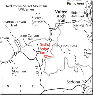
Location: About 42 miles south of Flagstaff (12 miles west of Sedona) on paved and graveled roads.
GPS: N34° 54' 10.26", W-111° 48' 49.716"
Access: Drive 27 miles south from Flagstaff to Sedona on US 89A. Continue through Sedona to Dry Creek Road (FR152) at the west end of town. Turn right on Dry Creek Road and drive for two miles to where FR152 forks and take the right fork (leaving the paved road). This road is rough, but can be traveled by passenger vehicles, high-clearance vehicles recommended. It is not recommended during wet weather. About 1.3 miles up this road, turn right to Devil's Bridge Trailhead and parking lot.