This trail not only provides a big dividend of scenery for a moderate outlay of exertion but it is easily accessible as well.
From the ample parking lot at its trailhead, the Doe Mountain Trail switchbacks directly up the north side of this low, flat-topped Mesa. As you climb, you'll want to take time out to enjoy the excellent views of the surrounding countryside. A layer of erosion resistant cap rock has given Doe Mountain its classic mesa shape and provides hikers with a great platform from which enjoy the panoramic view.
From this 400 foot high perspective, you can see a number of the Sedona Red Rocks Country's more prominent landmarks . You'll see Bear, Maroon and Wilson mountains, Loy, Boynton and Secret canyons, Chimney Rock, and the Cockscomb to name a few. Sedona is visible to the east and off to the south, Munds Mountain and Sycamore Pass mark the location of Sycamore Canyon and the Verde Valley.
This photo of Doe Mountain was supplied by Connie Birkland of the Red Rock District. It was taken in April, 2005.
Length: 0.7 miles to the top of the mesa, 1.3 miles around the edge.
USGS Map(s): Wilson Mountain
At a Glance
Open Season:
Year 'round
Closest Towns:
Sedona, AZ
Operated By:
Red Rock Ranger District - 928-203-2900
Information Center:
Hiking time: 2 hours round trip Notes: No motor vehicles
General Information
General Notes:
Directions:
Location: About 36 miles from Flagstaff (an hour and a half travel time); 5 miles (15 minutes) from Sedona. All roads are paved.
GPS: N34° 53' 37.14", W-111° 51' 55.224"
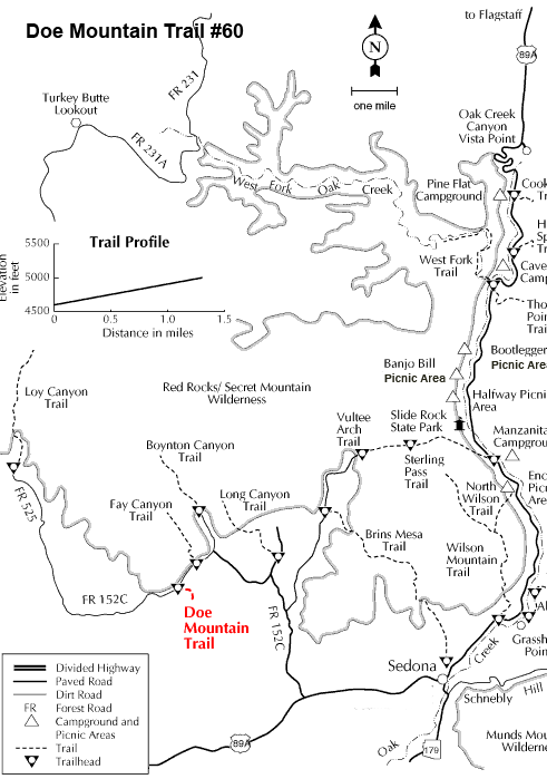
Access: Drive 27 miles south from Flagstaff to Sedona on US 89A. Continue through Sedona to Dry Creek Road at the west end of town. Turn north on Dry Creek Road (FR 152C) three miles to the Boynton Canyon intersection then left on FR 152C about a mile to the trailhead.