Most people come to Fay Canyon to see the natural arch that's located just under a mile up the trail. But those who don't know about it usually walk right past it. Though the Fay Canyon Arch is by no means small, it looks so much like an ordinary rock overhang it's easy to glance right at it and not realize what you've seen. If you keep watching the rock wall to the north (right) side of the trail sooner or later you'll spot it. Then the short, steep trail up to the arch can be a little hard to locate too.
After you've found the arch you may want to continue on up the trail. This small, hidden canyon supports a diverse community of desert plants and provides good views of the surrounding cliffs. The trail follows an old jeep track which eventually turns into a footpath. It dead ends at a red Supai sandstone cliff where you can see evidence of some ancient Indian dwellings and marvel at the breathtaking scenery that surrounds you.
Length: 1.1 miles
Rating: Easy
Hiking time: 1 hour round trip
Notes: No mechanized vehicles (including mountain bikes) in Wilderness. This trail can be hot and dry in summer. Please do not disturb ruins or remove artifacts.
At a Glance
Open Season:
Year 'round
Usage:
Medium
Closest Towns:
Sedona, AZ
Operated By:
Red Rock District - 928-203-2900
General Information
Latitude: 34.901929
Longitude: -111.85791
Length: 1.1 miles
Elevation: 4592 at trailhead
Accessibility:
Directions:
USGS Maps: Wilson Mountain
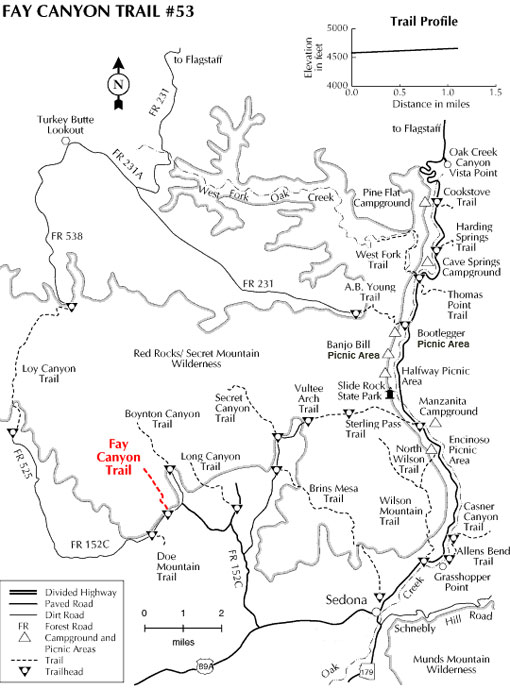
Location: 33 miles south of Flagstaff (2.5 miles west of Sedona) in scenic Red Rock Country on roads that are paved. Elevation is 4500 feet.
GPS: N34° 54' 7.4154", W-111° 51' 28.2594"
Access: Drive 27 miles south from Flagstaff to Sedona on US 89A. Continue through Sedona to Dry Creek Road (152C) at the west end of town. Turn north three miles to the Boynton Canyon intersection then left about a half mile to the Fay Canyon parking area on the left. Cross the street to the trailhead.