This easy to hike trail leads up a desert wilderness canyon offering excellent views not only at trail's end, but all along the way as well. The wide, well constructed path was used by the Samuel Loy family on the 1880's to move their livestock to and from summer pastures on the rim. The trail starts out by skirting the fence line of the Hancock Ranch. Sheer cliffs of vermilion and buff sandstone form a colorful backdrop for the desert garden of manzanita, catclaw, cholla and prickly pear that carpets the canyon floor. Natural rock sculptures carved by flash floods and spring runoff that seasonally course down this normally dry streambed provide scenic settings for lunch stops along the way. If there's been a recent rain the sculpture may include a picturesque reflecting pool or a natural bathtub for a cool dip on a hot day. Underground moisture is sufficient year-round to support a desert riparian area rich in bird and other animal life.
Near the end of the canyon, the trail completes the majority of the 1680 foot climb to a high saddle that leads to the top of a mesa called Secret Mountain. Here you can continue along the Secret Mountain Trail for more spectacular overlooks or catch your breath for the return trip and a different perspective on all that you've passed through on the hike up.
Rating: Moderate (last two miles difficult)
Hiking time: 6 hours round trip
Notes: No motorized vehicles, no mechanized vehicles in Wilderness
At a Glance
Open Season:
Year 'round
Usage:
Medium
Closest Towns:
Sedona, AZ
Operated By:
Red Rock District - 928-203-2900
General Information
Latitude: 34.93229
Longitude: -111.925016
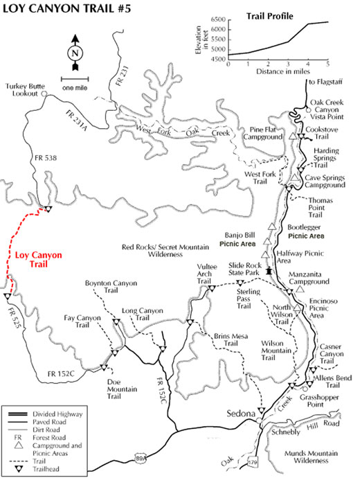
Length: 5 miles
Elevation: 4701 at trailhead
Directions:
USGS Maps: Loy Butte
Location: About 45 miles south of Flagstaff (14 miles west of Sedona) on paved and graveled roads. The elevationis 4720 feet.
GPS: N34° 55' 55.848", W-111° 55' 30.036"
Access: Drive 35 miles south from Flagstaff through Sedona on US 89A. 5 miles past Sedona turn north on FR 525 and follow the signs toward Loy Butte 9.3 miles to the trailhead. Watch for signs on your right and a parking area on your left just before crossing a cattleguard into the Hancock Ranch.