Named for a local settler, Sterling Pass Trail leads over a high saddle from Oak Creek Canyon into nearby and equally scenic Sterling Canyon. The climb is steep right from the trailhead. The trail climbs up an unnamed drainage through a mixed conifer forest dominated by huge orange-barked ponderosa pines. Dwarf canyon maples are plentiful here too. They turn scarlet and peach in the fall, making this a great place to enjoy the most colorful of seasons.
As you ascend the steep slope you'll notice that, above the mosaic of tree limbs that form the forest ceiling, huge monoliths of deep red and buff sandstone tower toward the sky. You'll be rubbing shoulders with these giants as you slide between them at the top of the pass and begin the descent into Sterling Canyon. The best overlooks are along the climb, so be sure to take a break every now and then to enjoy them. The view from the top is somewhat obscured by trees.
Rating: Moderate to strenuous
Hiking time: 1-1.5 hours
Notes:
No mechanized vehicles (including mountain bikes) in Wilderness.
This trail can be hot and dry in summer.
Please do not disturb ruins or remove artifacts.
At a Glance
Open Season:
Year 'round
Usage:
Medium
Best Season:
April - November
Closest Towns:
Sedona, AZ
Operated By:
Red Rock District - 928-203-2900
General Information
Latitude: 34.927384
Longitude: -111.734857
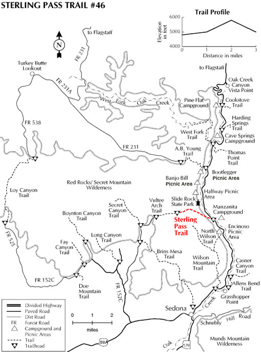
Length: 2.4 miles
Elevation: 4735 at trailhead
Directions:
USGS Maps: Munds Park, Wilson Mountain
Location: 22 miles south of Flagstaff (5.5 miles north of Sedona) on paved roads in scenic Oak Creek Canyon. Elevation is 4840 feet at the trailhead. Access: Drive 22 miles south out of Flagstaff or 5.5 miles north from Sedona. The trailhead is a bit hard to see but it's on the west side of the highway, near mile marker 380. It's about a hundred yards north of the entrance to Manzanita Campground and a short distance south of Slide Rock Lodge. Parking is available some distance away, south of Manzanita Campground, on the east side of the highway.