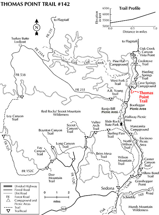
This is the southernmost of three trails that climb to the east rim of Oak Creek Canyon. Of the three, it offers the broadest and most varied views. However, it is also the hottest and longest. The Thomas Point Trail starts in a mixed conifer forest characteristic of Arizona canyons but quickly breaks out into more open chapparal. Above this point, vistas are broad and impressive with good views both down canyon, toward Sedona and the crimson bluffs near Slide Rock, and cross canyon to the steep cliffs of one of Oak Creek's largest tributaries, West Fork Canyon.
If you chose to continue all the way to the top, the trail winds through the manzanita and scrub oak to the canyon rim where you'll be rewarded with a nice view of the San Francisco Peaks near Flagstaff, about thirty miles away.
Rating: Moderate to strenuous
Hiking time: 1-1.5 hours round trip
Notes:
No motor vehicles.
This trail can be hot and dry in summer.
There is no water along this trail.
At a Glance
Open Season:
Year 'round
Usage:
Light-Medium
Closest Towns:
Sedona, AZ
Operated By:
Red Rock District - 928-203-2900
General Information
Latitude: 34.988692
Longitude: -111.744166
Length: 1 mile
Elevation: 5339 at trailhead
Directions:
USGS Maps: Munds Park
Location: 17.5 miles south of Flagstaff (9.5 miles north of Sedona) on paved roads in scenic Oak Creek Canyon. Elevation is 5400 feet at the trailhead.
Access: Drive south 17.5 miles south from Flagstaff or north 9.5 miles from Sedona to about halfway between milepost 385 and 384. The trailhead is on the east side of the highway across from a few houses. The best place to park is at the Call O' The Canyon day area about a quarter mile north of the trailhead. This is a fee parking area.