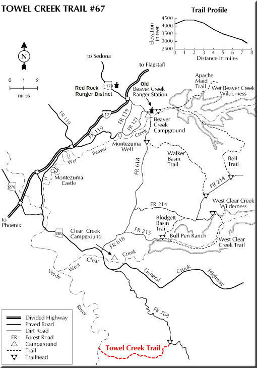
There's a classic western landscape waiting for you along this trail, with broad panoramas on the horizon and a collection of bluff-rimmed basins, basalt buttes, rocky canyons and lots of cactus covered desert closer at hand.
Once used mainly to move livestock between seasonal pastures, the Walker Basin Trail now provides forest visitors with an access route into this land of big skies and expansive views. A short distance from the upper trailhead, the panorama unfolds like a gigantic mural painted on the sky. Prominent on the horizon are the San Francisco Peaks, with the northern Arizona rim country stretching out at their feet. Wet Beaver Creek and Woods Canyons are obvious as jagged rifts in this otherwise flat plateau. Off to the west, the sculptured buttes and pinnacles of Sedona Red Rock Country are plainly visible.
The route leads from one forest road to another as it drops off the southern edge of the Colorado Plateau. For the best views you'll want to start from the upper end and walk downhill. That way you'll always be facing the broadest overlooks. From the trailhead, the route follows a rough jeep track through an old juniper push. Here the trees have been removed to promote grass growth for grazing. The trail quickly enters the trees, however, and wanders into Walker Basin, a forested depression rimmed by volcanic cliffs. The trail then gradually descends from the basin into a desert canyonscape of red rock cliffs, volcanic buttes, and prickly pear cactus.
Rating: Moderate
Hiking time: 4 hours
Notes: No motorized vehicles beyond the edge of the juniper push. This trail is a bit hard to find in places where rock pile cairns are all that mark the way. At Walker Mtn. Tank, follow the perimeter fence around the tank to a cairn at the northwest corner.
At a Glance
Open Season:
Year 'round
Usage:
Light
Closest Towns:
Sedona, AZ
Operated By:
Red Rock District - 928-203-2900
General Information
Latitude: 34.651914
Longitude: -111.705492
Length: 8 miles
Elevation: 3920 at north trailhead
Directions:
USGS Map(s): Walker Mtn.
Location: 53 miles south of Flagstaff on paved and graveled forest roads in picturesque Desert Canyon Country.
Access–Southern (higher in elevation) Trailhead: Drive 40 miles south of Flagstaff on Interstate 17 to the AZ 179 exit and turn east under the freeway. Drive about 9 miles on FR 618 to FR 214. Turn east and drive 7.3 miles to the trailhead where a jeep track turns off to the left. Elevation: 5972, latitude 34.584737, longitude -111.643256
Access–Northern (lower elevation) Trailhead: Drive 40 miles south of Flagstaff on Interstate 17 to the AZ 179 exit and turn east under the freeway. Drive 4.5 miles on FR 618 to FR 9201C. If you don't have a high clearance vehicle you will want to park here and walk the last mile to the trailhead. (see right column for elevation and lat/long)